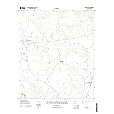
2017 Map of Greeleyville
USGS Topo · Published 2017About this map
Greeleyville and the surrounding Williamsburg County lowcountry are defined by an intricate network of wetlands and drainage basins shown in high detail. The landscape is characterized by prominent swamp systems like Rocky Ford Swamp and Chaney Swamp, which feed toward the Santee River along the southern border with Berkeley County. This modern survey illustrates the persistent rural settlement patterns centered on small hubs like Heineman and Edwards, while maintaining genealogical markers such as Mount Hope Cem and Richmond Cem. The mapping of unique local terrain, including Burgess Bay and Longlands House Pond, provides a clear view of how water dictates land use and road placement in this part of South Carolina. Local thoroughfares with descriptive names like Bloody Bucket Rd and Old Greeleyville Rd reflect the area's deep-rooted community history and transport networks.
Find a feature on this map
89 named features on this map. Tap any name to fly to it.
Don’t see what you’re looking for? This feature index may not catch every label — zoom into the map to look around manually.
Map Details
Editions of this 2017 Greeleyville Map
This is the sole edition of this map. No revisions or reprints were ever made.
Other maps of this area

1920 · Chicora
USGS Topo · 1:48,000

1920 · Manning
USGS Topo · 1:48,000

1921 · Chicora
USGS Topo · 1:62,500

1921 · Manning
USGS Topo · 1:62,500

1943 · Chicora
USGS Topo · 1:62,500

1943 · Bonneau
USGS Topo · 1:62,500

1944 · Manning
USGS Topo · 1:62,500

1946 · Kingstree
USGS Topo · 1:62,500

1949 · Georgetown
USGS Topo · 1:250,000

1954 · Augusta
USGS Topo · 1:250,000