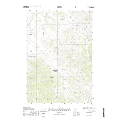
2020 Map of Green Creek
USGS Topo · Published 2020About this map
Custer National Forest lands dominate this corner of Rosebud County, where the high-plains topography is carved by a complex network of ephemeral creeks and seasonal draws. The landscape is defined by the Tongue River corridor in the northwest, which is paralleled by the Ashland-Birney Rd. Further into the interior, the terrain rises toward the O'Dell Divide, a prominent ridge separating the various forks of O'Dell Cr. Numerous livestock water sources and springs are scattered across these public lands, including Green Cr Reservoir, Poker Teechee Reservoir, and Pittman Reservoir. Small water features like Green Creek Spring and King Creek Spring emphasize the importance of water management in this cattle-grazing country. The presence of remote landmarks such as Black Canyon and Gooseberry Draw reflects the local vernacular and the functional naming of the terrain for navigation.
Find a feature on this map
35 named features on this map. Tap any name to fly to it.
Don’t see what you’re looking for? This feature index may not catch every label — zoom into the map to look around manually.
Map Details
Editions of this 2020 Green Creek Map
This is the sole edition of this map. No revisions or reprints were ever made.
Other maps of this area

1954 · Hardin
USGS Topo · 1:250,000

1957 · Hardin
USGS Topo · 1:250,000

1958 · Hardin
USGS Topo · 1:250,000

1958 · Hollowwood Creek
USGS Topo · 1:24,000

1966 · Browns Mountain
USGS Topo · 1:24,000

1966 · Ashland
USGS Topo · 1:24,000

1966 · Birney Day School
USGS Topo · 1:24,000

1966 · Poker Jim Butte
USGS Topo · 1:24,000

1966 · Fort Howes
USGS Topo · 1:24,000

1966 · King Mountain
USGS Topo · 1:24,000