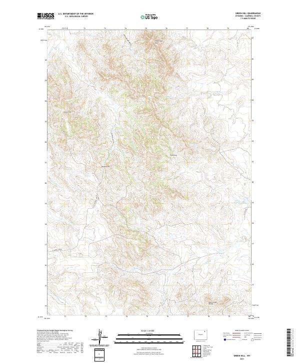
2021 Map of Green Hill
USGS Topo · Published 2021About this map
The Little Powder River flows through this corner of Campbell County, cutting a valley across a landscape defined by sharp drainage draws and high, named elevations. The terrain is notably rugged, rising from the riverbanks to features like the Deer Creek Breaks and the prominent Cow Creek Wall in the north. This area shows the intersection of ranching landscape and industrial infrastructure, where Oil Field Rd and N Garner Lake Rd navigate the ridges between creek beds. Named landmarks like Green Hill and Wreath Hill provide fixed points in a territory where water is scarce and managed, as evidenced by the presence of Allee Reservoir. Numerous ephemeral streams, including Provant Cr and Cow Cr, trace the complex erosional patterns typical of this part of Wyoming, while Hells Canyon Draw highlights the significant vertical relief that characterizes the local topography.
Find a feature on this map
25 named features on this map. Tap any name to fly to it.
Don’t see what you’re looking for? This feature index may not catch every label — zoom into the map to look around manually.
Map Details
Editions of this 2021 Green Hill Map
This is the sole edition of this map. No revisions or reprints were ever made.
Other maps of this area

1954 · Gillette
USGS Topo · 1:250,000

1955 · Gillette
USGS Topo · 1:250,000

1958 · Gillette
USGS Topo · 1:250,000

1962 · Gillette
USGS Topo · 1:250,000

1971 · Rozet
USGS Topo · 1:24,000

1971 · Gillette East
USGS Topo · 1:24,000
1971 · Rozet NW
USGS Topo · 1:24,000

1971 · Green Hill
USGS Topo · 1:24,000
1971 · Moyer Springs
USGS Topo · 1:24,000
1971 · Fortin Draw
USGS Topo · 1:24,000