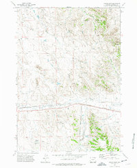
1971 Map of Fortin Draw
USGS Topo · Published 1975About this map
Burlington Northern rails cut through the heart of this Campbell County landscape, following the course of Donkey Creek across a terrain defined by coal and oil exploration. The 1970s marked a period of intensive industrial activity in this corner of Wyoming, evidenced by the numerous drill holes and oil wells scattered throughout Rozet Field. Notable local landmarks like the Baumfalk Mine and Baumfalk Reservoir indicate the impact of individual families and early mining operations on the land. To the north and south, the terrain becomes more complex as it rises into the Deer Creek Breaks and the Rochelle Hills. Water management is a primary theme of the settlement pattern here, with small impoundments such as Dutch Res and Oiler Reservoir appearing alongside the seasonal flows of Fortin Draw and the Little Powder River.
Find a feature on this map
24 named features on this map. Tap any name to fly to it.
Don’t see what you’re looking for? This feature index may not catch every label — zoom into the map to look around manually.
Map Details
Editions of this 1971 Fortin Draw Map
2 editions found
Other maps of this area

1954 · Gillette
USGS Topo · 1:250,000

1955 · Gillette
USGS Topo · 1:250,000

1958 · Gillette
USGS Topo · 1:250,000

1962 · Gillette
USGS Topo · 1:250,000

1971 · Coyote Draw
USGS Topo · 1:24,000

1971 · Coon Track Creek
USGS Topo · 1:24,000

1971 · Rozet
USGS Topo · 1:24,000

1971 · Gillette East
USGS Topo · 1:24,000
1971 · Rozet NW
USGS Topo · 1:24,000

1971 · Green Hill
USGS Topo · 1:24,000