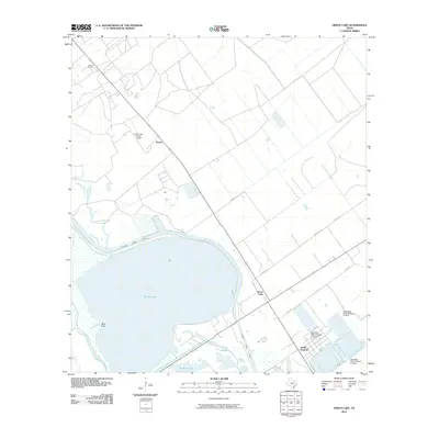
2010 Map of Green Lake
USGS Topo · Published 2010About this map
Heyser Oil Field and the eponymous Green Lake define this coastal landscape on the Texas Gulf Coast. The terrain is characterized by a complex network of waterways, including Hog Bayou, Black Bayou, and the Victoria Barge Canal, which cuts across the northern edge of the lake. Industrial and agricultural infrastructure is evident in the various levees near North Seadrift, including Operating Basin Number 31 Levee and Operating Basin Number 5 Levee. Small settlements like Heyser and the lakeside community of Green Lake are connected by a grid of rural roads such as Sparks Rd and Whatley Rd. Transportation for the local industry is further supported by the Green Lake Ranch Airport, highlighting the region's focus on resource extraction and maritime transit.
Find a feature on this map
21 named features on this map. Tap any name to fly to it.
Don’t see what you’re looking for? This feature index may not catch every label — zoom into the map to look around manually.
Map Details
Editions of this 2010 Green Lake Map
This is the sole edition of this map. No revisions or reprints were ever made.
Other maps of this area

1951 · Bloomington
USGS Topo · 1:24,000

1952 · Tivoli
USGS Topo · 1:24,000

1952 · Bloomington SW
USGS Topo · 1:24,000

1952 · Kamey
USGS Topo · 1:24,000

1952 · Austwell
USGS Topo · 1:24,000

1952 · Seadrift
USGS Topo · 1:24,000

1952 · Port Lavaca West
USGS Topo · 1:24,000

1952 · Placedo
USGS Topo · 1:24,000

1952 · Green Lake
USGS Topo · 1:24,000

1953 · Beeville
USGS Topo · 1:250,000