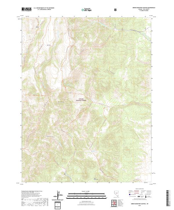
2021 Map of Green Monster Canyon
USGS Topo · Published 2021About this map
The Monitor Range defines the high-altitude topography of this interior Nevada landscape, characterized by a complex network of canyons and ridges within the Toiyabe National Forest. Historically significant names like Scuffe Pasture and Burnt Cabin Flat hint at the area's legacy of ranching and early habitation. The terrain is deeply carved by drainage systems including Green Monster Canyon and Dry Canyon, which provided natural corridors through the steep slopes.
Find a feature on this map
34 named features on this map. Tap any name to fly to it.
Don’t see what you’re looking for? This feature index may not catch every label — zoom into the map to look around manually.
Map Details
Editions of this 2021 Green Monster Canyon Map
This is the sole edition of this map. No revisions or reprints were ever made.
Other maps of this area

1956 · Tonopah
USGS Topo · 1:250,000

1959 · Tonopah
USGS Topo · 1:250,000

1962 · Tonopah
USGS Topo · 1:250,000

1967 · Upper Fish Lake
USGS Topo · 1:24,000

1968 · Morey Peak
USGS Topo · 1:62,500

1968 · Fish Springs
USGS Topo · 1:62,500
1968 · Fish Springs
USGS Topo · 1:24,000
1968 · Little Fish Lake
USGS Topo · 1:24,000

1971 · Barley Creek
USGS Topo · 1:24,000
1971 · Elkhorn Canyon
USGS Topo · 1:24,000