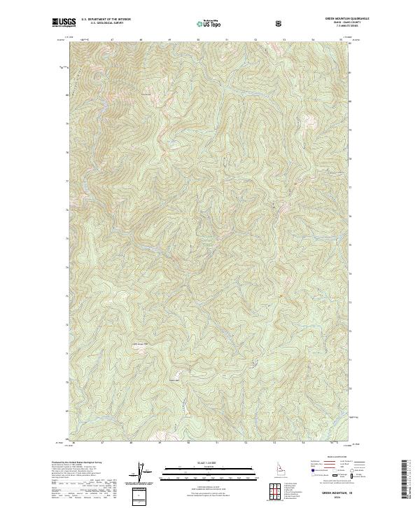
2024 Map of Green Mountain
USGS Topo · Published 2024About this map
Nez Perce National Forest encompasses this high-elevation landscape, where the Idaho wilderness is defined by sharp ridgelines and a network of deep drainage basins. The area is dominated by significant summits, including the primary peak of Green Mtn and the nearby Little Green Mtn, while Granite Peak stands at the northern edge of the survey. Primitive access is provided by a few high-country routes, notably Elk Mountain Rd and Running Creek Rd, which wind through the complex topography to connect remote points. Hydrological patterns are well-defined by numerous watercourses, such as the East Fork Meadow Creek and Three Prong Creek, which originate in these heights. Tucked among the peaks, Elk Lake provides a rare still-water feature in a terrain otherwise characterized by steep gradients and fast-moving streams like Bargamin Creek and Cabin Creek.
Find a feature on this map
20 named features on this map. Tap any name to fly to it.
Don’t see what you’re looking for? This feature index may not catch every label — zoom into the map to look around manually.
Map Details
Editions of this 2024 Green Mountain Map
This is the sole edition of this map. No revisions or reprints were ever made.
Other maps of this area

1956 · Elk City
USGS Topo · 1:250,000

1960 · Elk City
USGS Topo · 1:250,000

1966 · Green Mtn.
USGS Topo · 1:24,000

1966 · Three Prong Mountain
USGS Topo · 1:24,000
1966 · Wylies Peak
USGS Topo · 1:24,000

1966 · Sable Hill
USGS Topo · 1:24,000
1966 · Running Lake
USGS Topo · 1:24,000
1966 · Vermilion Peak
USGS Topo · 1:24,000

1977 · Boston Mtn
USGS Topo · 1:24,000

1978 · Spread Creek Point
USGS Topo · 1:24,000