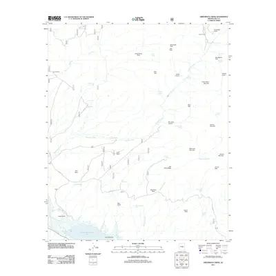
2011 Map of Greenback Creek
USGS Topo · Published 2011About this map
Theodore Roosevelt Lake dominates the southern edge of this Arizona landscape, where the waters meet Indian Point and Glendale Point. The map documents a rugged drainage system where Greenback Creek, Oak Creek, and Methodist Creek carve through high desert terrain defined by prominent elevations such as Horse Range Mesa and Cline Mesa.
Find a feature on this map
48 named features on this map. Tap any name to fly to it.
Don’t see what you’re looking for? This feature index may not catch every label — zoom into the map to look around manually.
Map Details
Editions of this 2011 Greenback Creek Map
This is the sole edition of this map. No revisions or reprints were ever made.
Other maps of this area

1907 · Roosevelt
USGS Topo · 1:125,000

1909 · Four Peaks
USGS Topo · 1:125,000

1912 · Roosevelt
USGS Topo · 1:125,000

1954 · Mesa
USGS Topo · 1:250,000

1957 · Mesa
USGS Topo · 1:250,000

1958 · Mesa
USGS Topo · 1:250,000

1960 · Mesa
USGS Topo · 1:250,000

1964 · Mesa
USGS Topo · 1:250,000
1964 · Kayler Butte
USGS Topo · 1:24,000
1964 · Armer Mountain
USGS Topo · 1:24,000