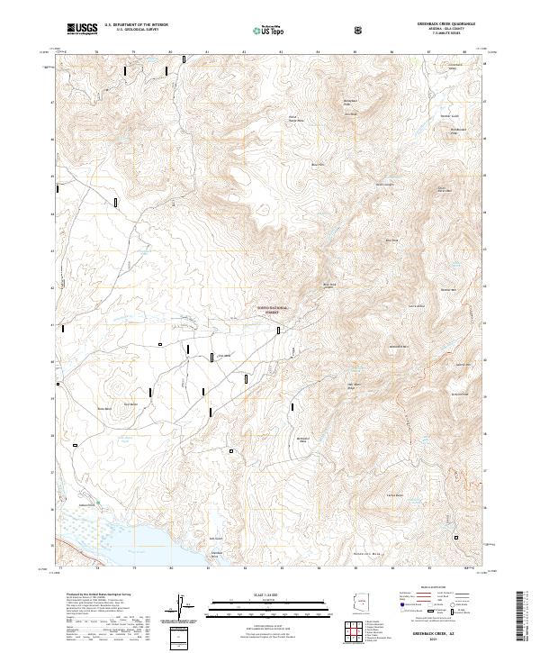
2021 Map of Greenback Creek
USGS Topo · Published 2021About this map
Tonto National Forest lands dominate this corner of Gila County, where the desert landscape meets the high ridges of the Sierra Ancha. The map centers on the drainages feeding the Roosevelt Lake area, primarily Tonto Creek and Greenback Creek. High elevations are marked by prominent summits like Boneyback Peak and Methodist Mtn, while lower plateaus such as Cline Mesa and Methodist Mesa suggest the traditional grazing and ranching patterns of the region. Local water sources, crucial for survival in this arid environment, are meticulously noted, including Edwards Spring, Panther Spring, and the artificial Greenback Tank. Near the southern edge, Tonto Basin and Indian Point overlook the riparian corridor, providing a detailed look at the trail systems like the Lost Goldmine Trl that navigate the difficult terrain of Devils Canyon.
Find a feature on this map
64 named features on this map. Tap any name to fly to it.
Don’t see what you’re looking for? This feature index may not catch every label — zoom into the map to look around manually.
Map Details
Editions of this 2021 Greenback Creek Map
This is the sole edition of this map. No revisions or reprints were ever made.
Other maps of this area

1907 · Roosevelt
USGS Topo · 1:125,000

1909 · Four Peaks
USGS Topo · 1:125,000

1912 · Roosevelt
USGS Topo · 1:125,000

1954 · Mesa
USGS Topo · 1:250,000

1957 · Mesa
USGS Topo · 1:250,000

1958 · Mesa
USGS Topo · 1:250,000

1960 · Mesa
USGS Topo · 1:250,000

1964 · Mesa
USGS Topo · 1:250,000
1964 · Kayler Butte
USGS Topo · 1:24,000
1964 · Armer Mountain
USGS Topo · 1:24,000