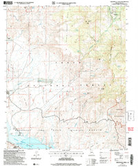
2004 Map of Greenback Creek
USGS Topo · Published 2007About this map
The rugged drainage basins of the Tonto National Forest dominate this landscape, where high-desert mesas give way to the deep waters of Roosevelt Lake. At the southern edge of the sheet, the Salt River corridor is marked by the State Wildlife Area and development around Glendale Point, while the northern reaches maintain a ranching character at Conway Ranch and Bouquet Ranch.
Find a feature on this map
53 named features on this map. Tap any name to fly to it.
Don’t see what you’re looking for? This feature index may not catch every label — zoom into the map to look around manually.
Map Details
Editions of this 2004 Greenback Creek Map
This is the sole edition of this map. No revisions or reprints were ever made.
Other maps of this area

1907 · Roosevelt
USGS Topo · 1:125,000

1909 · Four Peaks
USGS Topo · 1:125,000

1912 · Roosevelt
USGS Topo · 1:125,000

1954 · Mesa
USGS Topo · 1:250,000

1957 · Mesa
USGS Topo · 1:250,000

1958 · Mesa
USGS Topo · 1:250,000

1960 · Mesa
USGS Topo · 1:250,000

1964 · Mesa
USGS Topo · 1:250,000
1964 · Kayler Butte
USGS Topo · 1:24,000
1964 · Armer Mountain
USGS Topo · 1:24,000