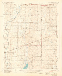
1938 Map of Greenbrier
USGS Topo · Published 1938About this map
The Southern railroad line cuts a straight path across the terrain of Limestone and Madison Counties, connecting the small agricultural hub of Greenbrier to the burgeoning community of Madison. This late 1930s landscape is characterized by a dense network of small rural institutions that anchored the local population, including Mt Pleasant Sch and Maple Grove Sch, alongside churches like St James Ch and Waldo Chapel. In the north, Burgreen Corner and Oakland serve as local landmarks near the meandering Limestone Creek.
Find a feature on this map
36 named features on this map. Tap any name to fly to it.
Don’t see what you’re looking for? This feature index may not catch every label — zoom into the map to look around manually.
Map Details
Editions of this 1938 Greenbrier Map
3 editions found
Other maps of this area

1888 · Huntsville
USGS Topo · 1:125,000

1892 · Huntsville
USGS Topo · 1:125,000

1935 · Athens
USGS Topo · 1:24,000

1936 · Jeff
USGS Topo · 1:24,000

1936 · Capshaw
USGS Topo · 1:24,000

1936 · Triana
USGS Topo · 1:24,000

1936 · Madison
USGS Topo · 1:24,000

1936 · Decatur
USGS Topo · 1:24,000

1936 · Mason Ridge
USGS Topo · 1:24,000

1936 · Tanner
USGS Topo · 1:24,000