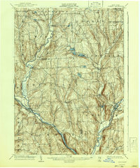
1904 Map of Greene
USGS Topo · Published 1942About this map
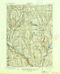
Whitney Point and the neighboring settlements of Triangle and Itaska form the southern hubs of this central New York landscape, situated where the Tioughnioga River meets the local topography. Surveyed just after the turn of the century, the map reveals a rural economy deeply tied to its waterways and valleys. The Delaware Lackawanna and Western RR cuts through the southwestern corner, providing a vital transport link for the surrounding agricultural towns. Small hamlets such as Smithville Flats, Willet, and Upper Lisle are connected by a network of early roads, while the upland areas are dotted with isolated points like Penelope and East German. Along the eastern edge, the Chenango River passes through Greene, showing the town's early development alongside the water. The map's high-relief contouring highlights the distinct drainage basins of Genegantslet Creek and several glacial features, including Cincinnatus Lake and Round Pond.
Find a feature on this map
45 named features on this map. Tap any name to fly to it.
Don’t see what you’re looking for? This feature index may not catch every label — zoom into the map to look around manually.
Map Details
Editions of this 1904 Greene Map
6 editions found
Other maps of this area

1901 · Apalachin
USGS Topo · 1:62,500

1902 · Coventry
USGS Topo · 1:62,500

1903 · Norwich
USGS Topo · 1:62,500

1903 · Cortland
USGS Topo · 1:62,500

1903 · Harford
USGS Topo · 1:62,500

1904 · Binghamton
USGS Topo · 1:62,500

1904 · Greene
USGS Topo · 1:62,500

1904 · Oxford
USGS Topo · 1:62,500

1904 · Apalachin
USGS Topo · 1:62,500

1904 · Pitcher
USGS Topo · 1:62,500