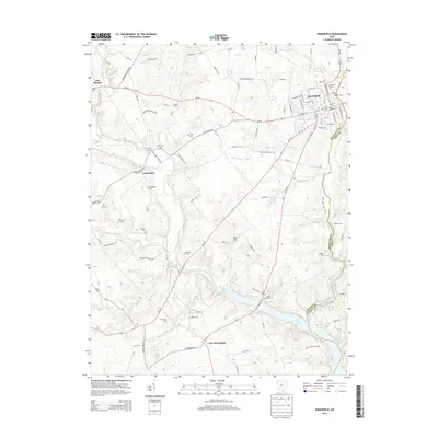
2013 Map of Greenfield
USGS Topo · Published 2013About this map
The town of Greenfield serves as the focal point of this Highland County landscape, where the confluence of residential streets and historic cemeteries like Greenfield Cem and Saint Josephs Cem marks a long-established community. The geography is defined by the winding course of Paint Creek, which eventually broadens into Paint Cr Lake near the southern boundary. Much of the eastern portion of the map is preserved within Paint Creek State Park, highlighting a transition from the structured grid of the town to the managed natural spaces along the water.
Find a feature on this map
100 named features on this map. Tap any name to fly to it.
Don’t see what you’re looking for? This feature index may not catch every label — zoom into the map to look around manually.
Map Details
Editions of this 2013 Greenfield Map
This is the sole edition of this map. No revisions or reprints were ever made.
Other maps of this area

1915 · Bainbridge
USGS Topo · 1:48,000

1917 · Bainbridge
USGS Topo · 1:62,500

1917 · Greenfield
USGS Topo · 1:62,500

1917 · Hillsboro
USGS Topo · 1:62,500

1917 · Sabina
USGS Topo · 1:62,500

1943 · Sabina
USGS Topo · 1:62,500

1944 · Hillsboro
USGS Topo · 1:62,500

1944 · Greenfield
USGS Topo · 1:62,500

1947 · Columbus
USGS Topo · 1:250,000

1960 · Greenfield
USGS Topo · 1:24,000