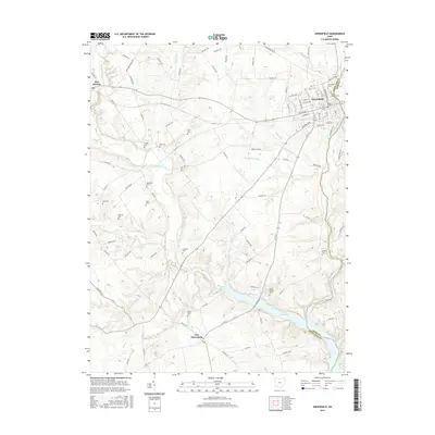
2016 Map of Greenfield
USGS Topo · Published 2016About this map
Greenfield serves as the primary hub of this landscape at the Highland and Ross County line, where the street grid includes landmarks like Saint Josephs Cem and Greenfield Cem. The topography is defined by the winding course of Paint Creek, which feeds into the substantial Paint Creek Lake in the southeast quadrant. This waterway system, joined by tributaries like Rattlesnake Creek and Fall Cr, historically dictated the placement of early settlements and rural burial grounds. Genealogists will find a high density of small family or pioneer cemeteries scattered across the countryside, including Crispin Cem, Huff Cem, and Gilboa Cem near the village of New Petersburg. The transition from the structured blocks of Greenfield to the rural outskirts of East Monroe illustrates the persistent agricultural and residential patterns of this part of southern Ohio.
Find a feature on this map
102 named features on this map. Tap any name to fly to it.
Don’t see what you’re looking for? This feature index may not catch every label — zoom into the map to look around manually.
Map Details
Editions of this 2016 Greenfield Map
This is the sole edition of this map. No revisions or reprints were ever made.
Other maps of this area

1915 · Bainbridge
USGS Topo · 1:48,000

1917 · Bainbridge
USGS Topo · 1:62,500

1917 · Greenfield
USGS Topo · 1:62,500

1917 · Hillsboro
USGS Topo · 1:62,500

1917 · Sabina
USGS Topo · 1:62,500

1943 · Sabina
USGS Topo · 1:62,500

1944 · Hillsboro
USGS Topo · 1:62,500

1944 · Greenfield
USGS Topo · 1:62,500

1947 · Columbus
USGS Topo · 1:250,000

1960 · Greenfield
USGS Topo · 1:24,000