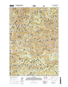
2017 Map of Greenhorn
USGS Topo · Published 2017About this map
Greenhorn and the nearby site of Robinsonville anchor this survey of the high mountain terrain along the border of Baker Co and Grant Co. This area, deeply marked by its mining heritage, features numerous drainages like Quartz Gulch, Three Cent Gulch, and California Gulch that hint at the gold-seeking history of the region. The map provides a detailed look at the hydraulic infrastructure of a bygone era, specifically the Placer Ditch which cuts across the slopes above Greenhorn Cr.
Find a feature on this map
69 named features on this map. Tap any name to fly to it.
Don’t see what you’re looking for? This feature index may not catch every label — zoom into the map to look around manually.
Map Details
Editions of this 2017 Greenhorn Map
This is the sole edition of this map. No revisions or reprints were ever made.
Other maps of this area
1901 · Sumpter
USGS Topo · 1:125,000
1951 · Bates
USGS Topo · 1:62,500
1951 · Desolation Butte
USGS Topo · 1:62,500
1955 · Canyon City
USGS Topo · 1:250,000
1959 · Canyon City
USGS Topo · 1:250,000
1961 · Whitney
USGS Topo · 1:24,000
1972 · Austin
USGS Topo · 1:24,000
1972 · Mt. Ireland
USGS Topo · 1:24,000
1972 · Granite
USGS Topo · 1:24,000
1972 · Greenhorn
USGS Topo · 1:24,000