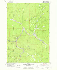
1972 Map of Granite
USGS Topo · Published 1976About this map
Granite and the ghost of Alamo (Site) sit at the heart of a landscape defined by decades of hard-rock mining and hydraulic operations within the Wallowa-Whitman National Forest and Umatilla National Forest. This 1972 field-checked survey reveals an intricate network of mineral extraction sites, from the Buffalo Mine and New York Mine in the north to the Red Boy Mine and Blackjack Mine further south. The topography is scarred by the industrial history of the Blue Mountains, most notably through extensive Dredge Tailings that follow the course of Granite Creek.
Find a feature on this map
78 named features on this map. Tap any name to fly to it.
Don’t see what you’re looking for? This feature index may not catch every label — zoom into the map to look around manually.
Map Details
Editions of this 1972 Granite Map
2 editions found
Other maps of this area

1901 · Sumpter
USGS Topo · 1:125,000

1951 · Bates
USGS Topo · 1:62,500

1951 · Desolation Butte
USGS Topo · 1:62,500

1955 · Canyon City
USGS Topo · 1:250,000

1959 · Canyon City
USGS Topo · 1:250,000

1961 · Whitney
USGS Topo · 1:24,000

1972 · Trout Meadows
USGS Topo · 1:24,000

1972 · Mt. Ireland
USGS Topo · 1:24,000

1972 · Greenhorn
USGS Topo · 1:24,000
1972 · Crawfish Lake
USGS Topo · 1:24,000