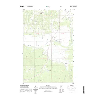
2020 Map of Greenough
USGS Topo · Published 2020About this map
Ninemile Prairie and the valley of the Blackfoot River dominate this portion of Missoula County, where the transition from river bottom to timbered highlands is clearly defined. The small settlements of Barite, Greenough, and Sunset serve as local anchors along the transportation corridors that follow the natural topography. Significant portions of the northern landscape are protected within the Lolo National Forest, where features like Game Ridge and Black Canyon rise above the river valley.
Find a feature on this map
46 named features on this map. Tap any name to fly to it.
Don’t see what you’re looking for? This feature index may not catch every label — zoom into the map to look around manually.
Map Details
Editions of this 2020 Greenough Map
This is the sole edition of this map. No revisions or reprints were ever made.
Other maps of this area

1902 · Ovando
USGS Topo · 1:125,000

1903 · Bonner
USGS Topo · 1:125,000

1905 · Ovando
USGS Topo · 1:125,000

1919 · Drummond
USGS Topo · 1:125,000

1921 · Drummond
USGS Topo · 1:125,000

1921 · Elbow Lake
USGS Topo · 1:125,000

1947 · Butte
USGS Topo · 1:250,000

1955 · Choteau
USGS Topo · 1:250,000

1957 · Choteau
USGS Topo · 1:250,000

1958 · Butte
USGS Topo · 1:250,000