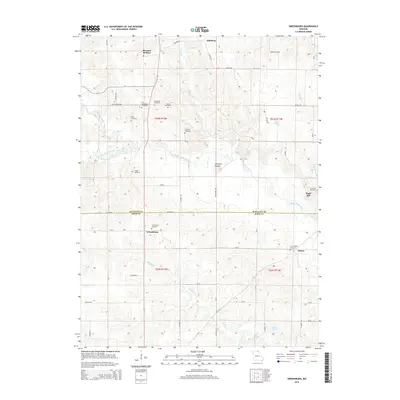
2015 Map of Greensburg
USGS Topo · Published 2015About this map
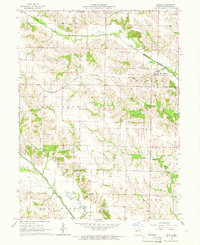
Pleasant Retreat and Greensburg anchor this agricultural landscape in northeastern Missouri, where the headwaters of the Fabius River system carve through the terrain. The map reveals a dense network of family and community history, evidenced by the high concentration of small burial grounds scattered across the townships, including Fort Donaldson Cemetery, Hicks Cemetery, and Frogge Cemetery. The boundary between Scotland Co Knox Co bisects the area, with Sand Hill and Fabius serving as smaller settlement markers. The hydrology is dominated by the North Fork Middle Fabius River and South Fork Middle Fabius River, which converge to form the Middle Fabius River. Notable landmarks such as Spillman Mound and the waters of Sever Lake N further define the local topography, which is woven together by a grid of county roads and historic routes like Fort Donaldson road.
Find a feature on this map
58 named features on this map. Tap any name to fly to it.
Don’t see what you’re looking for? This feature index may not catch every label — zoom into the map to look around manually.
Map Details
Editions of this 2015 Greensburg Map
This is the sole edition of this map. No revisions or reprints were ever made.
Other maps of this area

1903 · Edina
USGS Topo · 1:125,000

1954 · Centerville
USGS Topo · 1:250,000

1957 · Centerville
USGS Topo · 1:250,000

1958 · Centerville
USGS Topo · 1:250,000

1965 · Memphis
USGS Topo · 1:24,000
1965 · Knox City
USGS Topo · 1:24,000
1965 · Rutledge
USGS Topo · 1:24,000
1965 · Edina
USGS Topo · 1:24,000
1965 · Arbela
USGS Topo · 1:24,000

1965 · Greensburg
USGS Topo · 1:24,000