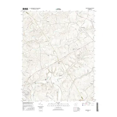
2016 Map of Greensburg
USGS Topo · Published 2016About this map
Greensburg anchors the southwestern corner of this survey, where the Green River carves a winding path through the limestone-rich terrain of central Kentucky. The river’s sharp meander at Cox Bend creates a series of named islands, including Marcum Island, White Island, and Snaps Island, illustrating the dynamic nature of the waterway. This landscape is a patchwork of small agricultural communities and family landmarks, connected by a dense network of country roads. Numerous family burial sites, such as the Cowherd Cem, Chaney Cem, and Marshall Cem, are scattered across the uplands between Big Pitman Creek and its tributaries. The map also captures several uniquely named settlements like Black Gnat and Bluff Boom, reflecting the deep-rooted local history of Taylor and Green counties. These scattered hamlets and family cemeteries provide a detailed map of the region’s rural settlement patterns and genealogical heritage.
Find a feature on this map
120 named features on this map. Tap any name to fly to it.
Don’t see what you’re looking for? This feature index may not catch every label — zoom into the map to look around manually.
Map Details
Editions of this 2016 Greensburg Map
This is the sole edition of this map. No revisions or reprints were ever made.
Other maps of this area

1953 · Campbellsville
USGS Topo · 1:24,000

1953 · Saloma
USGS Topo · 1:24,000

1953 · Hibernia
USGS Topo · 1:24,000

1953 · Summersville
USGS Topo · 1:24,000

1953 · Exie
USGS Topo · 1:24,000

1953 · Gresham
USGS Topo · 1:24,000

1953 · Spurlington
USGS Topo · 1:24,000

1953 · Cane Valley
USGS Topo · 1:24,000

1954 · Greensburg
USGS Topo · 1:24,000

1957 · Winchester
USGS Topo · 1:250,000