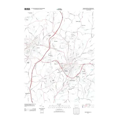
2013 Map of Greensburg
USGS Topo · Published 2013About this map
Southwest Greensburg and its neighboring boroughs form a dense suburban landscape in the hills of Westmoreland County. The area’s coal-mining heritage is subtly noted by features like Coal Hollow and Coal Tar Run, while the modern commercial and residential expansion is evident in the cluster of named neighborhoods like Basforth Acres, Beech Hills, and Maplewood Terrace. Transportation corridors such as the Pennsylvania Turnpike and local routes anchor the map, connecting the outlying settlements of Claridge and Bovard to the central urban core.
Find a feature on this map
224 named features on this map. Tap any name to fly to it.
Don’t see what you’re looking for? This feature index may not catch every label — zoom into the map to look around manually.
Map Details
Editions of this 2013 Greensburg Map
This is the sole edition of this map. No revisions or reprints were ever made.
Other maps of this area

1900 · Latrobe
USGS Topo · 1:62,500

1902 · Latrobe
USGS Topo · 1:62,500

1902 · Connellsville
USGS Topo · 1:62,500

1903 · Latrobe
USGS Topo · 1:62,500

1904 · Greensburg
USGS Topo · 1:62,500

1906 · Greensburg
USGS Topo · 1:62,500

1922 · Donegal
USGS Topo · 1:62,500

1931 · Connellsville
USGS Topo · 1:62,500

1935 · Donegal
USGS Topo · 1:62,500

1936 · Connellsville
USGS Topo · 1:62,500
Featured Places
- Greensburg, PA
- Jeannette, PA
- Southwest Greensburg, PA
- South Greensburg, PA
- Grapeville, Hempfield Township