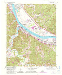
1972 Map of Greenup
USGS Topo · Published 1985About this map
The Ohio River serves as the primary artery for industry and transport in this early 1970s survey, separating the settlements of Greenup and Wurtland in Kentucky from Haverhill and Franklin Furnace in Ohio. The riverbank is dominated by the heavy rail infrastructure of the Chesapeake and Ohio and Norfolk and Western railroads, which facilitated the movement of coal and timber through the tri-state region. Inland from the river, the landscape shifts from industrial corridors to the winding valleys of the Little Sandy River and Raccoon Creek.
Find a feature on this map
67 named features on this map. Tap any name to fly to it.
Don’t see what you’re looking for? This feature index may not catch every label — zoom into the map to look around manually.
Map Details
Editions of this 1972 Greenup Map
3 editions found
Other maps of this area

1898 · Ironton
USGS Topo · 1:62,500

1900 · Ironton
USGS Topo · 1:62,500

1901 · Ceredo
USGS Topo · 1:62,500

1903 · Kenova
USGS Topo · 1:125,000

1904 · Kenova
USGS Topo · 1:125,000

1913 · Ceredo
USGS Topo · 1:62,500

1926 · Greenup
USGS Topo · 1:48,000

1930 · Greenup
USGS Topo · 1:62,500

1953 · Oldtown
USGS Topo · 1:24,000
1953 · Load
USGS Topo · 1:24,000