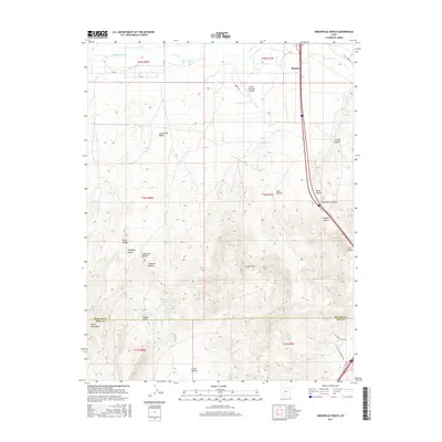
2017 Map of Greenville Bench
USGS Topo · Published 2017About this map
The town of Beaver sits at the northern edge of this high-desert plateau, where the Beaver River and a network of irrigation systems like the Aberdare Canal and Barton Ditch supported the region's agricultural development. The landscape is defined by the prominent Greenville Bench, which drops away into a complex series of drainage features including Hell Canyon and Jockeys Canyon. This 2017 survey illustrates the intricate water management of the area, noting several small catchment points such as Lee Pond, Jims Reservoir, and Howards Pond. To the south, the terrain transitions into the South Hills and the northern reaches of the Black Mountains, where numerous family-named landmarks like Teddys Valley and Shannon Hollow provide specific points of interest for local history researchers. The presence of the Beaver Municipal Airport and Airport Rd marks the modern infrastructure serving this corridor between the Beaver and Iron County lines.
Find a feature on this map
42 named features on this map. Tap any name to fly to it.
Don’t see what you’re looking for? This feature index may not catch every label — zoom into the map to look around manually.
Map Details
Editions of this 2017 Greenville Bench Map
This is the sole edition of this map. No revisions or reprints were ever made.
Other maps of this area

1885 · Beaver
USGS Topo · 1:250,000

1953 · Richfield
USGS Topo · 1:250,000

1954 · Beaver SE
USGS Topo · 1:24,000

1958 · Richfield
USGS Topo · 1:250,000

1958 · Minersville
USGS Topo · 1:62,500

1958 · Beaver
USGS Topo · 1:62,500

1958 · Adamsville
USGS Topo · 1:62,500

1971 · Buckhorn Flat
USGS Topo · 1:24,000
1971 · Burnt Peak
USGS Topo · 1:24,000
1971 · Kane Canyon
USGS Topo · 1:24,000