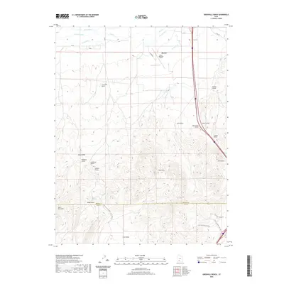
2020 Map of Greenville Bench
USGS Topo · Published 2020About this map
Beaver River and a complex network of irrigation channels, including the Aberdare Canal, Patterson Ditch, and S Field Ditch, define the agricultural landscape north of the South Hills. This high-desert terrain is characterized by the broad Greenville Bench and numerous named hollows such as Negro Hollow, Lockjaw Hollow, and California Hollow.
Find a feature on this map
37 named features on this map. Tap any name to fly to it.
Don’t see what you’re looking for? This feature index may not catch every label — zoom into the map to look around manually.
Map Details
Editions of this 2020 Greenville Bench Map
This is the sole edition of this map. No revisions or reprints were ever made.
Other maps of this area

1885 · Beaver
USGS Topo · 1:250,000

1953 · Richfield
USGS Topo · 1:250,000

1954 · Beaver SE
USGS Topo · 1:24,000

1958 · Richfield
USGS Topo · 1:250,000

1958 · Minersville
USGS Topo · 1:62,500

1958 · Beaver
USGS Topo · 1:62,500

1958 · Adamsville
USGS Topo · 1:62,500

1971 · Buckhorn Flat
USGS Topo · 1:24,000
1971 · Burnt Peak
USGS Topo · 1:24,000
1971 · Kane Canyon
USGS Topo · 1:24,000