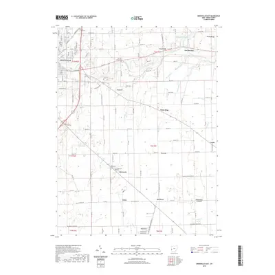
2019 Map of Greenville East
USGS Topo · Published 2019About this map
Greenville Creek meanders eastward through this Darke County landscape, anchoring a series of small rural communities and historic sites. The landmark Bears Mill stands as a notable point of interest along the waterway, representing the region's long-standing connection to local water-powered industry. Surrounding the city of Greenville, the terrain is defined by a dense network of township and county roads that link outlying settlements such as Abbottsville, Nineveh, and Gettysburg.
Find a feature on this map
109 named features on this map. Tap any name to fly to it.
Don’t see what you’re looking for? This feature index may not catch every label — zoom into the map to look around manually.
Map Details
Editions of this 2019 Greenville East Map
This is the sole edition of this map. No revisions or reprints were ever made.
Other maps of this area

1905 · Brookville
USGS Topo · 1:62,500

1911 · Covington
USGS Topo · 1:62,500

1944 · Covington
USGS Topo · 1:62,500

1953 · Cincinnati
USGS Topo · 1:250,000

1953 · Muncie
USGS Topo · 1:250,000

1956 · Muncie
USGS Topo · 1:250,000

1957 · Cincinnati
USGS Topo · 1:250,000

1960 · New Madison
USGS Topo · 1:24,000

1961 · Laura
USGS Topo · 1:24,000

1961 · Dawn
USGS Topo · 1:24,000