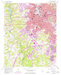
1957 Map of Greenville
USGS Topo · Published 1977About this map
Greenville serves as the bustling hub of this 1957 survey, showing the city's mid-century expansion across the Reedy River and into the surrounding textile communities. The landscape is defined by its industrial roots, with mill-associated settlements like Monaghan, Woodside, and Judson anchoring the urban core. To the west, the Saluda River and Saluda Lake provide a sharp contrast to the dense network of the Southern and Seaboard Coast Line railroads. The map records several educational landmarks from this era, including the Furman University (Womens College) campus and schools like Sterling High Sch.
Find a feature on this map
87 named features on this map. Tap any name to fly to it.
Don’t see what you’re looking for? This feature index may not catch every label — zoom into the map to look around manually.
Map Details
Editions of this 1957 Greenville Map
2 editions found
Other maps of this area

1888 · Pickens
USGS Topo · 1:125,000

1894 · Pickens
USGS Topo · 1:125,000

1935 · Greenville
USGS Topo · 1:48,000

1938 · Greenville
USGS Topo · 1:62,500

1954 · Greenville
USGS Topo · 1:250,000

1957 · Greenville
USGS Topo · 1:24,000

1957 · Anderson
USGS Topo · 1:62,500

1957 · Easley
USGS Topo · 1:62,500

1957 · Williamston
USGS Topo · 1:62,500

1957 · Greenville
USGS Topo · 1:62,500