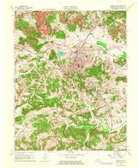
1963 Map of Greenville
USGS Topo · Published 1964About this map
Greenville serves as the focal point of this Muhlenberg County landscape during the early 1960s, a period marked by the expansion of the Western Kentucky Parkway across the northern reaches. The area's industrial character is defined by a heavy concentration of Strip Mines and numerous Oil Wells, particularly around Hillside and Luzerne. The Illinois Central railroad corridor links the major settlements, providing a transportation backbone for the local coal and resource economy.
Find a feature on this map
37 named features on this map. Tap any name to fly to it.
Don’t see what you’re looking for? This feature index may not catch every label — zoom into the map to look around manually.
Map Details
Editions of this 1963 Greenville Map
4 editions found
Other maps of this area

1909 · Madisonville
USGS Topo · 1:62,500

1909 · Central City
USGS Topo · 1:62,500

1911 · Drakesboro
USGS Topo · 1:48,000

1912 · Nortonville
USGS Topo · 1:62,500

1913 · Drakesboro
USGS Topo · 1:62,500

1952 · Greenville
USGS Topo · 1:24,000

1953 · Drakesboro
USGS Topo · 1:24,000

1953 · Haleys Mill
USGS Topo · 1:24,000

1953 · Rosewood
USGS Topo · 1:24,000

1953 · Central City West
USGS Topo · 1:24,000