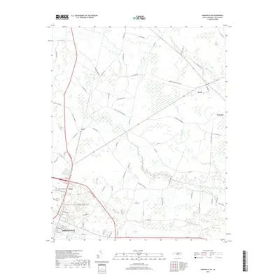
2019 Map of Greenville NE
USGS Topo · Published 2019About this map
Greenville serves as the anchor for this 2019 survey of northern Pitt County, where the city’s residential and industrial growth meets the rural agricultural landscape of the coastal plain. Significant water features like Grindle Creek and Baldwin Swamp define the low-lying drainage patterns of the area, punctuated by small crossroads settlements such as Stokes, Staton, and Whichard. The map reveals a transition from the urban density of the city's northern limits to a patchwork of timberland and farms, linked by a network of local thoroughfares including N Memorial Dr and Stokes Elementary School Rd. Local history is visible in the distribution of family-named roads like Alexander-Brown RD and David Nobles RD, illustrating the deep-rooted landownership patterns that have persisted even as the region modernizes.
Find a feature on this map
72 named features on this map. Tap any name to fly to it.
Don’t see what you’re looking for? This feature index may not catch every label — zoom into the map to look around manually.
Map Details
Editions of this 2019 Greenville NE Map
This is the sole edition of this map. No revisions or reprints were ever made.
Other maps of this area

1901 · Parmele
USGS Topo · 1:62,500

1901 · Williamston
USGS Topo · 1:62,500

1902 · Williamston
USGS Topo · 1:62,500

1902 · Parmele
USGS Topo · 1:62,500

1903 · Winterville
USGS Topo · 1:62,500

1903 · Chocowinity
USGS Topo · 1:62,500

1905 · Chocowinity
USGS Topo · 1:62,500

1905 · Winterville
USGS Topo · 1:62,500

1953 · Rocky Mount
USGS Topo · 1:250,000

1954 · Rocky Mount
USGS Topo · 1:250,000