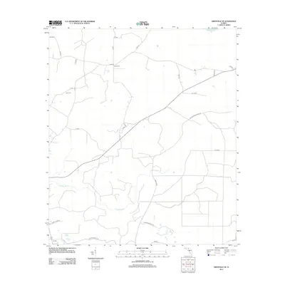
2012 Map of Greenville SE
USGS Topo · Published 2012About this map
Moseley Hall and Lake Bird anchor this rural landscape in Taylor County, where the terrain is defined by the winding course of the Econfina River. The map reveals a network of county roads and local routes that connect isolated settlements and family landmarks, such as Bailey Cem near Bailey Cem. The northern edge of the sheet reaches the shores of Sampala Lake, while the eastern portion is dominated by the expansive San Pedro Bay WMA Ent 26. Notable for genealogists and local historians, the grid of secondary roads like Harrison Andrews Rd and Albert Hendry Rd highlights the persistent footprint of family names in the Florida panhandle's timber and agricultural lands during the early 21st century.
Find a feature on this map
27 named features on this map. Tap any name to fly to it.
Don’t see what you’re looking for? This feature index may not catch every label — zoom into the map to look around manually.
Map Details
Editions of this 2012 Greenville SE Map
This is the sole edition of this map. No revisions or reprints were ever made.
Other maps of this area

1952 · Secotan
USGS Topo · 1:24,000

1954 · Boyd
USGS Topo · 1:24,000

1954 · Secotan
USGS Topo · 1:24,000

1954 · Day NW
USGS Topo · 1:24,000

1954 · Greenville
USGS Topo · 1:24,000

1954 · Greenville NE
USGS Topo · 1:24,000

1954 · Valdosta
USGS Topo · 1:250,000

1955 · Shady Grove
USGS Topo · 1:24,000

1955 · Greenville SE
USGS Topo · 1:24,000

1958 · Valdosta
USGS Topo · 1:250,000