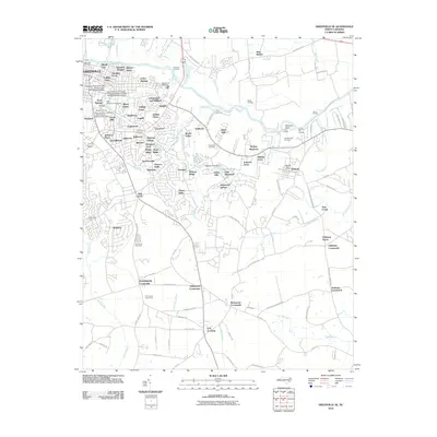
2010 Map of Greenville SE
USGS Topo · Published 2010About this map
Greenville dominates the northwestern portion of this coastal plain landscape, where the Tar River snakes eastward toward numerous boat landings. The expansion of residential neighborhoods like Johnston Heights, Heritage Village, and Tuckahoe reflects the city's growth around the East Carolina University main campus. To the south, the terrain shifts from suburban density to a more traditional rural layout, characterized by the Pitt County Poor Farm and several crossroads settlements such as Worthingtons Crossroads and Galloway Crossroads.
Find a feature on this map
127 named features on this map. Tap any name to fly to it.
Don’t see what you’re looking for? This feature index may not catch every label — zoom into the map to look around manually.
Map Details
Editions of this 2010 Greenville SE Map
This is the sole edition of this map. No revisions or reprints were ever made.
Other maps of this area

1902 · Ayden
USGS Topo · 1:62,500

1902 · Vanceboro
USGS Topo · 1:62,500

1903 · Winterville
USGS Topo · 1:62,500

1903 · Chocowinity
USGS Topo · 1:62,500

1904 · Ayden
USGS Topo · 1:62,500

1904 · Vanceboro
USGS Topo · 1:62,500

1905 · Chocowinity
USGS Topo · 1:62,500

1905 · Winterville
USGS Topo · 1:62,500

1905 · Vanceboro
USGS Topo · 1:62,500

1953 · Rocky Mount
USGS Topo · 1:250,000