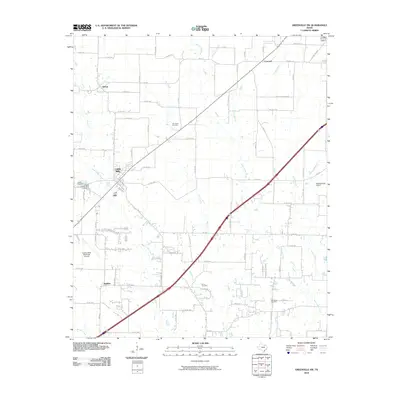
2010 Map of Greenville SW
USGS Topo · Published 2010About this map
Caddo Mills stands as the primary hub in this southwest Hunt County landscape, where the local economy and geography are defined by the various branches of Caddo Creek. The area is characterized by several small, established communities such as Clinton and Concord, connected by a dense network of farm-to-market roads and county routes. For those tracing family history, the map includes several burial sites, notably Elm Creek Cemetery, Stone Cemetery, and Van Sickle Cemetery. Transportation and aviation are prominent features, with both the Caddo Mills Municipal Airport and Meadowview Airport serving the region. The drainage patterns of West Caddo Creek and East Caddo Creek illustrate the low-lying terrain typical of this part of North Texas, while landmarks like the City of Caddo Mills Lake Dam indicate local water management efforts in the early 21st century.
Find a feature on this map
82 named features on this map. Tap any name to fly to it.
Don’t see what you’re looking for? This feature index may not catch every label — zoom into the map to look around manually.
Map Details
Editions of this 2010 Greenville SW Map
This is the sole edition of this map. No revisions or reprints were ever made.
Other maps of this area

1919 · Royse City
USGS Topo · 1:62,500

1930 · Farmersville
USGS Topo · 1:62,500

1954 · Dallas
USGS Topo · 1:250,000

1954 · Sherman
USGS Topo · 1:250,000

1956 · Quinlan
USGS Topo · 1:62,500

1958 · Dallas
USGS Topo · 1:250,000

1958 · Sherman
USGS Topo · 1:250,000

1962 · Greenville NW
USGS Topo · 1:24,000

1962 · Greenville SW
USGS Topo · 1:24,000

1962 · Greenville SE
USGS Topo · 1:24,000