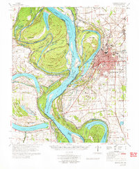
1972 Map of Greenville
USGS Topo · Published 1972About this map
Greenville serves as the focal point for this 1970s study of the Mississippi River floodplain, where the river's shifting path defines the boundary between Mississippi and Arkansas. The intricate network of oxbow lakes, including Lake Chicot, Lake Ferguson, and Lake Lee, illustrates the hydraulic history of the delta. Local landmarks such as Winterville State Park and several Indian Mounds point to a deep pre-colonial history of the region. The map captures the infrastructure of the early 1970s, from the Illinois Central railroad lines and U.S. 82 to the numerous rural churches like The Old Evening Star Ch and Mt Zion Ch that anchor the surrounding agricultural landscape. Extensive drainage projects are visible through a numbered system of ditches, such as Ditch No 5 and Ditch No 10, which transformed the lowlands for cultivation.
Find a feature on this map
70 named features on this map. Tap any name to fly to it.
Don’t see what you’re looking for? This feature index may not catch every label — zoom into the map to look around manually.
Map Details
Editions of this 1972 Greenville Map
This is the sole edition of this map. No revisions or reprints were ever made.
Other maps of this area

1933 · Lamont
USGS Topo · 1:62,500

1936 · McGehee
USGS Topo · 1:62,500

1936 · Eudora
USGS Topo · 1:62,500

1936 · Lake Village
USGS Topo · 1:62,500

1937 · McGehee
USGS Topo · 1:62,500

1939 · Readland
USGS Topo · 1:62,500

1939 · Refuge
USGS Topo · 1:62,500

1939 · Lamont
USGS Topo · 1:62,500

1939 · Tralake
USGS Topo · 1:62,500

1939 · Choctaw
USGS Topo · 1:62,500