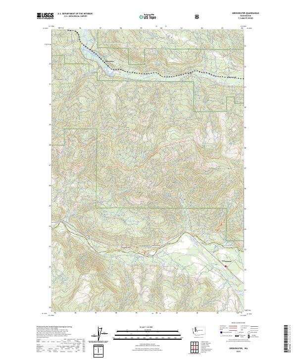
2023 Map of Greenwater
USGS Topo · Published 2023About this map
Greenwater sits at the confluence of the White River and the Greenwater River, serving as a central point in this mountain landscape within the Snoqualmie National Forest. The geography is defined by significant elevation changes, ranging from the river valleys to the heights of Grass Mountain and Huckleberry Mtn. This survey captures the region's character as a timber and recreation corridor, where the King and Pierce County line follows the natural divide.
Find a feature on this map
49 named features on this map. Tap any name to fly to it.
Don’t see what you’re looking for? This feature index may not catch every label — zoom into the map to look around manually.
Map Details
Editions of this 2023 Greenwater Map
This is the sole edition of this map. No revisions or reprints were ever made.
Other maps of this area

1913 · Cedar Lake
USGS Topo · 1:125,000

1953 · Eagle Gorge
USGS Topo · 1:24,000

1956 · Greenwater
USGS Topo · 1:62,500

1956 · Enumclaw
USGS Topo · 1:62,500

1957 · Wenatchee
USGS Topo · 1:250,000

1960 · Bandera
USGS Topo · 1:62,500

1975 · Snoqualmie Pass
USGS Topo · 1:100,000
1986 · Bearhead Mtn
USGS Topo · 1:24,000
1986 · Nagrom
USGS Topo · 1:24,000
1986 · Clear West Peak
USGS Topo · 1:24,000