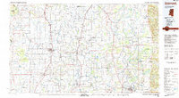
1983 Map of Greenwood
USGS Topo · Published 1983About this map
The Mississippi River forms the western boundary of this 1983 study, defining a landscape of complex waterways and fertile delta plains. Central to the region is the State Penitentiary, a prominent landmark located near Drew. The settlement pattern follows the Illinois Central Gulf Railroad, which links towns like Cleveland, Mound Bayou, and Ruleville. These communities represent the agricultural and social core of the Mississippi Delta during the late twentieth century, showing a high density of small towns and municipal infrastructure such as the Cleveland Municipal Airport.
Find a feature on this map
144 named features on this map. Tap any name to fly to it.
Don’t see what you’re looking for? This feature index may not catch every label — zoom into the map to look around manually.
Map Details
Editions of this 1983 Greenwood Map
This is the sole edition of this map. No revisions or reprints were ever made.
Other maps of this area

1930 · Mellwood
USGS Topo · 1:62,500

1931 · Schlater
USGS Topo · 1:48,000

1931 · Sumner
USGS Topo · 1:48,000

1931 · Drew
USGS Topo · 1:48,000

1932 · Philipp
USGS Topo · 1:48,000

1932 · Tutwiler
USGS Topo · 1:48,000

1933 · Lamont
USGS Topo · 1:62,500

1934 · Cleveland
USGS Topo · 1:62,500

1934 · Schlater
USGS Topo · 1:62,500

1935 · Clarksdale
USGS Topo · 1:62,500