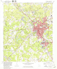
1978 Map of Greenwood
USGS Topo · Published 1979About this map
The city of Greenwood serves as the central hub of this late-1970s survey, showing a dense network of neighborhoods such as Grendel Village, Mathews Village, and Panola Village surrounding the downtown core. The landscape is a mix of educational institutions like Lander College and Greenwood High Sch, and vital community landmarks including Self Memorial Hospital and the Maxwell Childrens Home. To the west, the terrain transitions into the protected woodlands of the Sumter National Forest, while the northern reaches include the County Airport and the community of The Willows.
Find a feature on this map
115 named features on this map. Tap any name to fly to it.
Don’t see what you’re looking for? This feature index may not catch every label — zoom into the map to look around manually.
Map Details
Editions of this 1978 Greenwood Map
This is the sole edition of this map. No revisions or reprints were ever made.
Other maps of this area

1892 · Abbeville
USGS Topo · 1:125,000

1908 · Kirksey
USGS Topo · 1:24,000

1948 · Abbeville East
USGS Topo · 1:24,000

1948 · Verdery
USGS Topo · 1:24,000

1949 · Ninety-Six
USGS Topo · 1:24,000

1949 · Greenwood
USGS Topo · 1:24,000

1950 · Bradley
USGS Topo · 1:24,000

1950 · Kirksey
USGS Topo · 1:24,000

1950 · Verdery
USGS Topo · 1:24,000

1950 · Abbeville East
USGS Topo · 1:24,000