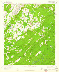
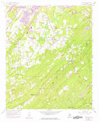
1959 Map of Greenwood
USGS Topo · Published 1960About this map
The industrialized landscape of central Alabama comes to life across Red Mountain and the surrounding valleys as they appeared in the late 1950s. The region is defined by the intersection of natural topography and extractive industry, marked by numerous mines, a Chert Pit, and a Gravel Pit that indicate the area's geological wealth. The rail network is dense, featuring the Atlantic Coast Line, Southern, and Louisville and Nashville railroads, which served the various mining settlements such as Raimund and Coalmont. Transportation hubs like Mobile Junction and the Bessemer Airport contrast with more remote landmarks like Potato Hill on Chestnut Ridge. Local life is anchored by family-named sites and rural institutions, including Sadlers Cem, Lacey's Chapel, and Canaan Ch. Significant water features like the Cahaba River and Shades Creek snake through the terrain, providing a natural backdrop to the expanding footprints of Greenwood and Phillips Estates.
Find a feature on this map
75 named features on this map. Tap any name to fly to it.
Don’t see what you’re looking for? This feature index may not catch every label — zoom into the map to look around manually.
Map Details
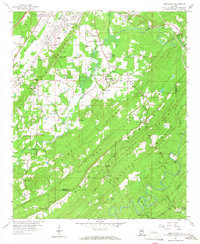
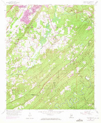
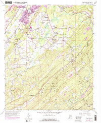
Editions of this 1959 Greenwood Map
5 editions found
Other maps of this area

1890 · Bessemer
USGS Topo · 1:125,000

1892 · Bessemer
USGS Topo · 1:125,000

1899 · Brookwood
USGS Topo · 1:125,000

1905 · Bessemer Iron District
USGS Topo · 1:62,500

1907 · Bessemer Special
USGS Topo · 1:62,500

1910 · Montevallo
USGS Topo · 1:62,500

1927 · Adger
USGS Topo · 1:48,000

1932 · Yolande
USGS Topo · 1:62,500

1934 · Blocton
USGS Topo · 1:48,000

1935 · Yolande
USGS Topo · 1:62,500