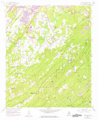
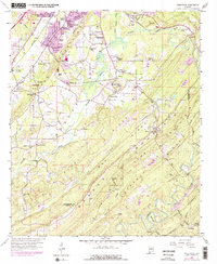
1959 Map of Greenwood
USGS Topo · Published 1978About this map
Shades Mountain and the Bluff Ridges dominate this landscape south of Bessemer, where the industrial and suburban expansion of Jefferson County meets the winding course of the Cahaba River. The map documents a transition from established mining and transit hubs like Mobile Junction and Eastern Valley to newer residential developments such as Phillips Estates. Significant infrastructure including the Bessemer Airport and multiple Strip Mine operations underscore the region's mid-century economic character.
Find a feature on this map
69 named features on this map. Tap any name to fly to it.
Don’t see what you’re looking for? This feature index may not catch every label — zoom into the map to look around manually.
Map Details
Editions of this 1959 Greenwood Map
5 editions found
Other maps of this area

1890 · Bessemer
USGS Topo · 1:125,000

1892 · Bessemer
USGS Topo · 1:125,000

1899 · Brookwood
USGS Topo · 1:125,000

1905 · Bessemer Iron District
USGS Topo · 1:62,500

1907 · Bessemer Special
USGS Topo · 1:62,500

1910 · Montevallo
USGS Topo · 1:62,500

1927 · Adger
USGS Topo · 1:48,000

1932 · Yolande
USGS Topo · 1:62,500

1934 · Blocton
USGS Topo · 1:48,000

1935 · Yolande
USGS Topo · 1:62,500