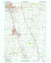
1973 Map of Greenwood
USGS Topo · Published 1980About this map
Greenwood and the surrounding townships of Pleasant, Clark, and Franklin appear in a period of significant suburban expansion during the 1970s. The core of this Johnson County landscape is defined by the Conrail line and the north-south corridor connecting New Whiteland and Whiteland. While residential developments like those near Break-O-Day Sch mark the growing population, much of the surrounding territory retains its agricultural character, crisscrossed by essential drainage systems like Campbell Ditch and Graham Ditch.
Find a feature on this map
49 named features on this map. Tap any name to fly to it.
Don’t see what you’re looking for? This feature index may not catch every label — zoom into the map to look around manually.
Map Details
Editions of this 1973 Greenwood Map
3 editions found
Other maps of this area

1942 · Franklin
USGS Topo · 1:125,000

1942 · Columbus
USGS Topo · 1:125,000

1947 · Franklin
USGS Topo · 1:62,500

1948 · Franklin
USGS Topo · 1:24,000

1948 · Maywood
USGS Topo · 1:24,000

1948 · Beech Grove
USGS Topo · 1:24,000

1948 · Trafalgar
USGS Topo · 1:24,000

1948 · Marietta
USGS Topo · 1:24,000

1950 · Franklin
USGS Topo · 1:62,500

1950 · Edinburg
USGS Topo · 1:62,500