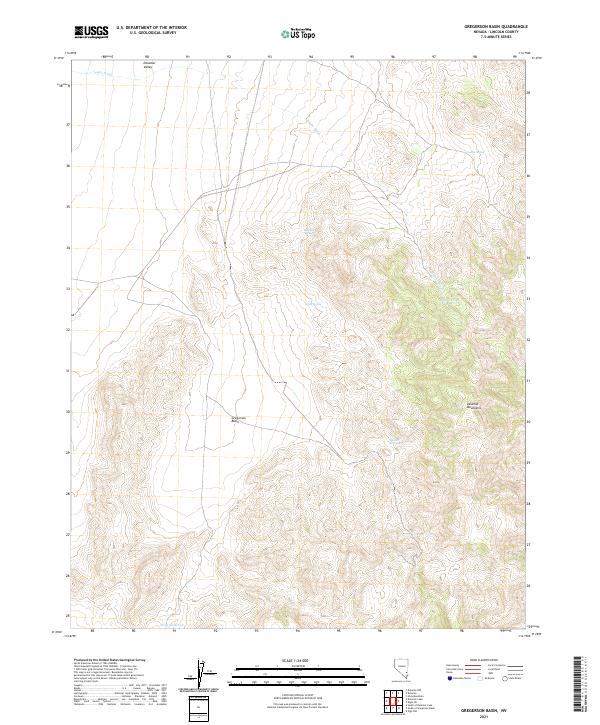
2021 Map of Gregerson Basin
USGS Topo · Published 2021About this map
Gregerson Basin sits at the heart of this high-desert landscape, tucked between the rising slopes of the Delamar Mountains to the east and the open expanse of Delamar Valley to the northwest. This 2021 survey reveals a territory where survival depends on dispersed water sources, marked by several named springs that have likely served as vital landmarks for generations. Jumbo Spring, Ben Hur Spring, Holly Spring, and Stewart Spring are scattered across the mountainous terrain, while Pony Reservoir sits in the flatter southwestern reaches. The drainage pattern is dominated by Jumbo Wash, which cuts across the northern quadrangle. This map documents the intersection of modern cartographic precision and the enduring, arid geography of Lincoln County.
Find a feature on this map
15 named features on this map. Tap any name to fly to it.
Don’t see what you’re looking for? This feature index may not catch every label — zoom into the map to look around manually.
Map Details
Editions of this 2021 Gregerson Basin Map
This is the sole edition of this map. No revisions or reprints were ever made.
Other maps of this area

1885 · Pioche
USGS Topo · 1:250,000

1886 · Pioche
USGS Topo · 1:250,000

1954 · Caliente
USGS Topo · 1:250,000

1959 · Caliente
USGS Topo · 1:250,000

1969 · Vigo NW
USGS Topo · 1:24,000

1969 · Delamar
USGS Topo · 1:24,000

1969 · Gregerson Basin
USGS Topo · 1:24,000

1969 · Delamar 3 NE
USGS Topo · 1:24,000
1969 · Delamar 3 NW
USGS Topo · 1:24,000

1969 · Slidy Mountain
USGS Topo · 1:24,000