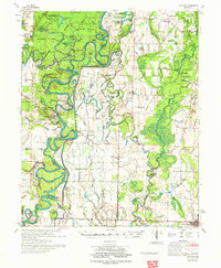
1972 Map of Gregory
USGS Topo · Published 1972About this map
White River and Cache River oxbows dominate this eastern Arkansas landscape, where the shifting riverbeds have created a labyrinth of sloughs and ponds within the Hurricane Lake State Game Area. The map reveals a transition from these dense wetlands to the agricultural lands of eastern Woodruff and Prairie counties. Significant early river-bottom landmarks include Peach Orchard Bluff and Smokehouse Bluff, while the commercial center of Cotton Plant anchoring the southeast corner demonstrates the proximity of rail and farm life. This 1970s survey captures the region's complex hydrological management, including the Lower White River and Cache River Valley drainage patterns. Small communities and rural gathering places such as Gregory Sch, St Paul Ch, and the Indian Mound Cemetery provide specific points of interest for local history and genealogy research.
Find a feature on this map
120 named features on this map. Tap any name to fly to it.
Don’t see what you’re looking for? This feature index may not catch every label — zoom into the map to look around manually.
Map Details
Editions of this 1972 Gregory Map
2 editions found
Other maps of this area

1932 · Kensett
USGS Topo · 1:62,500

1935 · Kensett
USGS Topo · 1:62,500

1935 · Hazen
USGS Topo · 1:62,500

1935 · Augusta
USGS Topo · 1:62,500

1935 · Gregory
USGS Topo · 1:62,500

1935 · Bald Knob
USGS Topo · 1:62,500

1939 · Hunter
USGS Topo · 1:62,500

1940 · Brinkley
USGS Topo · 1:62,500

1940 · Tilton
USGS Topo · 1:62,500

1941 · Hazen
USGS Topo · 1:62,500