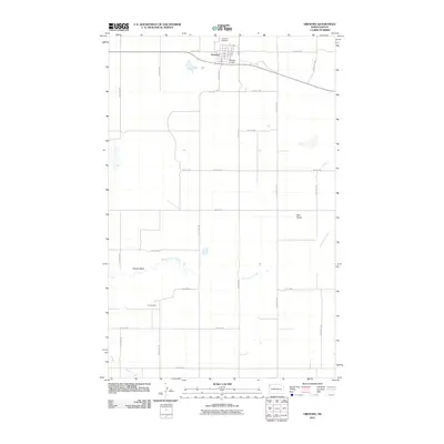
2011 Map of Grenora
USGS Topo · Published 2011About this map
Grenora occupies the northern reaches of this landscape, serving as a hub for the surrounding agricultural plains in Williams County. The town site is defined by a grid of streets including 2nd Ave and 3rd Ave, supported by aviation facilities at the Grenora Airport and Grenora Airfield. To the south, the topography is shaped by the winding paths of Cottonwood Creek and Willow Creek, which provide drainage through a region characterized by prominent rises such as Sowers Bluff and Barr Butte. Evidence of the area's extraction history is visible at the Fulveg Mine, located south of the main town. A structured network of section-line roads, such as 80th St NW and County Hwy-12, crisscrosses the prairie, reflecting the enduring legacy of the Public Land Survey System on North Dakota's rural geography.
Find a feature on this map
28 named features on this map. Tap any name to fly to it.
Don’t see what you’re looking for? This feature index may not catch every label — zoom into the map to look around manually.
Map Details
Editions of this 2011 Grenora Map
This is the sole edition of this map. No revisions or reprints were ever made.
Other maps of this area

1946 · Brush Lake
USGS Topo · 1:24,000

1948 · Grenora
USGS Topo · 1:24,000

1948 · Hanks
USGS Topo · 1:24,000

1948 · Brush Lake
USGS Topo · 1:24,000

1953 · Williston
USGS Topo · 1:250,000

1954 · Wolf Point
USGS Topo · 1:250,000

1957 · Williston
USGS Topo · 1:250,000

1958 · Wolf Point
USGS Topo · 1:250,000

1974 · Bonetraill
USGS Topo · 1:24,000

1974 · Brush Mountain
USGS Topo · 1:24,000