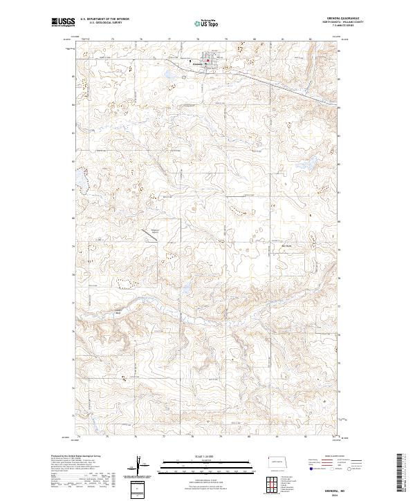
2024 Map of Grenora
USGS Topo · Published 2024About this map
Grenora stands as the primary hub of activity on this modern topographic study of northwestern Williams County. The town is structured around its transit links, with Railroad Ave and Co Hwy 5 anchoring the local grid. Just north of the town center lies the Grenora Cem, a significant site for local genealogical research. The surrounding landscape is characterized by its agricultural layout, defined by an orderly network of rural roads like Co Hwy 12 and 151st Ave NW. Natural drainages such as Cottonwood Creek and Willow Creek carve through the prairie, leading toward prominent elevations like Barr Butte and Sowers Bluff. Further south, the Peterson Airport serves as a remote landmark in this high-plains environment, illustrating the ongoing importance of regional aviation in isolated farming communities.
Find a feature on this map
31 named features on this map. Tap any name to fly to it.
Don’t see what you’re looking for? This feature index may not catch every label — zoom into the map to look around manually.
Map Details
Editions of this 2024 Grenora Map
This is the sole edition of this map. No revisions or reprints were ever made.
Other maps of this area

1946 · Brush Lake
USGS Topo · 1:24,000

1948 · Grenora
USGS Topo · 1:24,000

1948 · Hanks
USGS Topo · 1:24,000

1948 · Brush Lake
USGS Topo · 1:24,000

1953 · Williston
USGS Topo · 1:250,000

1954 · Wolf Point
USGS Topo · 1:250,000

1957 · Williston
USGS Topo · 1:250,000

1958 · Wolf Point
USGS Topo · 1:250,000

1974 · Bonetraill
USGS Topo · 1:24,000

1974 · Brush Mountain
USGS Topo · 1:24,000