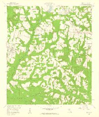
1959 Map of Gretna
USGS Topo · Published 1960About this map
The Forbes Purchase boundary lines define much of this Gadsden County landscape, reflecting the intricate land subdivisions of the mid-20th century. The town of Gretna serves as a hub for the Seaboard Air Line railroad, while nearby Greensboro and the settlement of Sawdust anchor the surrounding agricultural and timbered terrain. Water is a dominant feature throughout the quadrangle, with Telogia Creek and Little Telogia Creek winding through the center, feeding into local landmarks like Hanna Millpond and Shepards Millpond.
Find a feature on this map
45 named features on this map. Tap any name to fly to it.
Don’t see what you’re looking for? This feature index may not catch every label — zoom into the map to look around manually.
Map Details
Editions of this 1959 Gretna Map
2 editions found
Other maps of this area

1943 · Lake Talquin
USGS Topo · 1:62,500

1945 · Hosford
USGS Topo · 1:31,680

1954 · Tallahassee
USGS Topo · 1:250,000

1955 · Sycamore
USGS Topo · 1:24,000

1955 · Chattahoochee
USGS Topo · 1:24,000

1955 · Mt Pleasant
USGS Topo · 1:24,000

1956 · Dogtown
USGS Topo · 1:24,000

1959 · Tallahassee
USGS Topo · 1:250,000

1959 · Gretna
USGS Topo · 1:24,000

1959 · Quincy
USGS Topo · 1:24,000