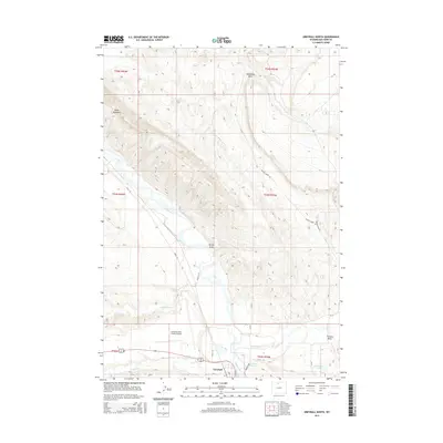
2015 Map of Greybull North
USGS Topo · Published 2015About this map
Greybull sits at the southern edge of this landscape, where the Bighorn River meets the drainages of Shell Creek and Dry Creek. The area is defined by sharp topographic contrasts, from the prominent heights of Sheep Mountain and the distinctive formation of Steamship Rock to the low-lying alluvial plains supporting the South Big Horn County Airport. The settlement patterns follow the river valley and the network of county roads like Rimrock Road and Crystal Creek Road, which provide access to the surrounding draws and water features. Hydrological infrastructure is evident in the presence of Garnett Reservoir and Garnett Lake near the confluence of the Bighorn and Shell Creek. The terrain is marked by significant erosion patterns, seen in features such as Porter Draw and Frenchy Draw, which channel seasonal runoff into the larger river system.
Find a feature on this map
30 named features on this map. Tap any name to fly to it.
Don’t see what you’re looking for? This feature index may not catch every label — zoom into the map to look around manually.
Map Details
Editions of this 2015 Greybull North Map
This is the sole edition of this map. No revisions or reprints were ever made.
Other maps of this area

1898 · Bald Mountain
USGS Topo · 1:125,000

1901 · Bald Mountain
USGS Topo · 1:125,000

1955 · Cody
USGS Topo · 1:250,000

1955 · Sheridan
USGS Topo · 1:250,000

1958 · Cody
USGS Topo · 1:250,000

1958 · Sheridan
USGS Topo · 1:250,000

1960 · Devils Kitchen
USGS Topo · 1:24,000

1960 · Bear Creek Ranch
USGS Topo · 1:24,000

1960 · Wild Horse Flats
USGS Topo · 1:24,000

1962 · Sheridan
USGS Topo · 1:250,000