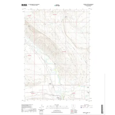
2017 Map of Greybull North
USGS Topo · Published 2017About this map
The Bighorn River carves a central path through this Wyoming landscape, defining the geography north of the town of Greybull. The terrain is marked by significant geological features, most notably the prominent Sheep Mountain to the west and the distinct Steamship Rock overlooking the drainage of Bear Cr in the north. The convergence of water and transportation is evident where Shell Creek and Dry Cr meet the river near the town center. Local infrastructure supports the region's connectivity, including the South Big Horn County Airport and a network of rural routes such as Crystal Creek Rd and Rimrock Rd. Named topographical depressions like Porter Draw and Frenchy Draw further detail the arid basin environment, while Garnett Lake provides a localized water feature amidst the high plains and rugged draws.
Find a feature on this map
29 named features on this map. Tap any name to fly to it.
Don’t see what you’re looking for? This feature index may not catch every label — zoom into the map to look around manually.
Map Details
Editions of this 2017 Greybull North Map
This is the sole edition of this map. No revisions or reprints were ever made.
Other maps of this area

1898 · Bald Mountain
USGS Topo · 1:125,000

1901 · Bald Mountain
USGS Topo · 1:125,000

1955 · Cody
USGS Topo · 1:250,000

1955 · Sheridan
USGS Topo · 1:250,000

1958 · Cody
USGS Topo · 1:250,000

1958 · Sheridan
USGS Topo · 1:250,000

1960 · Devils Kitchen
USGS Topo · 1:24,000

1960 · Bear Creek Ranch
USGS Topo · 1:24,000

1960 · Wild Horse Flats
USGS Topo · 1:24,000

1962 · Sheridan
USGS Topo · 1:250,000