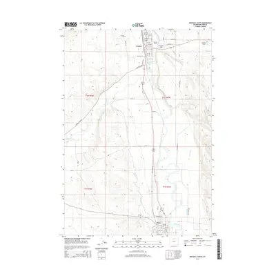
2015 Map of Greybull South
USGS Topo · Published 2015About this map
The confluence of the Greybull River and the Bighorn River anchors this central Wyoming landscape, where the town of Greybull sits at the northern edge and Basin serves as the southern hub. This geography is defined by a sophisticated network of irrigation including the Big Horn Canal, Shell Canal, and Tilard Canal, which support agriculture in the river valleys. The topography is marked by distinctive drainages such as Schroll Draw, Frenchy Draw, and the curiously named Tin Can Alley. Local history is anchored at either end of the river stretch by the Greybull Cem and the Basin Cem. The map illustrates a developed transport and rural infrastructure, from the residential grids of the two primary settlements to the outlying agricultural reaches along Greybull River Rd and Basin Garden Rd.
Find a feature on this map
58 named features on this map. Tap any name to fly to it.
Don’t see what you’re looking for? This feature index may not catch every label — zoom into the map to look around manually.
Map Details
Editions of this 2015 Greybull South Map
This is the sole edition of this map. No revisions or reprints were ever made.
Other maps of this area

1898 · Bald Mountain
USGS Topo · 1:125,000

1901 · Bald Mountain
USGS Topo · 1:125,000

1955 · Cody
USGS Topo · 1:250,000

1955 · Sheridan
USGS Topo · 1:250,000

1958 · Cody
USGS Topo · 1:250,000

1958 · Sheridan
USGS Topo · 1:250,000

1960 · Manderson
USGS Topo · 1:24,000

1960 · Devils Kitchen
USGS Topo · 1:24,000

1960 · Wild Horse Flats
USGS Topo · 1:24,000

1962 · Sheridan
USGS Topo · 1:250,000