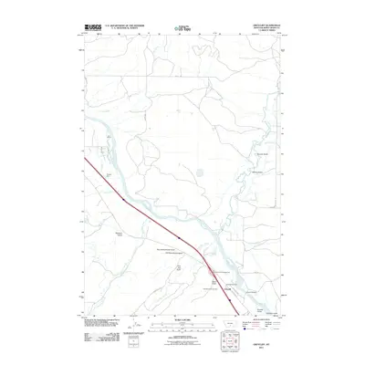
2011 Map of Greycliff
USGS Topo · Published 2011About this map
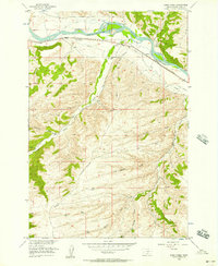
The Yellowstone River cuts a wide path through this Sweet Grass County landscape, creating a central corridor for transportation and settlement. The community of Greycliff sits on the southern bank, defined by the proximity of the Greycliff Post Office and the notable Greycliff Bridge. This 2011 survey reveals a territory where modern infrastructure, like the Big Timber KOA Campground, exists alongside traditional land use at the Boe Ranch. The local geography is heavily marked by numerous drainages including Sweet Grass Creek and Cox Creek. Of particular interest to local historians are the evocative names of the terrain, such as Old Schoolhouse Gulch and New Schoolhouse Gulch, which point toward the shifting locations of early rural education centers. The northern reaches of the map are defined by a network of ranch roads including Howie Rd and Spannering Rd.
Find a feature on this map
36 named features on this map. Tap any name to fly to it.
Don’t see what you’re looking for? This feature index may not catch every label — zoom into the map to look around manually.
Map Details
Editions of this 2011 Greycliff Map
This is the sole edition of this map. No revisions or reprints were ever made.
Other maps of this area

1891 · Big Timber
USGS Topo · 1:125,000

1893 · Big Timber
USGS Topo · 1:125,000

1954 · Big Timber
USGS Topo · 1:24,000
1954 · Ross Canyon
USGS Topo · 1:24,000
1954 · Otter Creek School
USGS Topo · 1:24,000
1954 · Ryan Creek
USGS Topo · 1:24,000

1954 · Billings
USGS Topo · 1:250,000

1955 · Packsaddle Butte
USGS Topo · 1:24,000

1955 · Greycliff
USGS Topo · 1:24,000
1956 · Work Creek
USGS Topo · 1:24,000