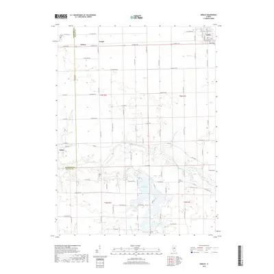
2018 Map of Gridley
USGS Topo · Published 2018About this map
The Mackinaw River carves a winding path across the center of this Central Illinois landscape, marking the transition between the agricultural plains of Woodford Co and McLean County. The river valley is a distinct departure from the rectilinear grid of the surrounding prairie, where small settlements like El Paso and Gridley are situated along primary corridors. To the south, the expansion of the Lake Bloomington reservoir dominates the drainage of Money Creek, creating an irregular shoreline that contrasts with the township and range section lines. Genealogists and local historians can find several established burial grounds, including the El Paso Cem at the western edge and the Wilcox-Coon Cem near the lake. The map also captures the smaller crossroads of Enright and Kappa, providing a look at the rural infrastructure that supports the region's long-standing farming economy.
Find a feature on this map
76 named features on this map. Tap any name to fly to it.
Don’t see what you’re looking for? This feature index may not catch every label — zoom into the map to look around manually.
Map Details
Editions of this 2018 Gridley Map
This is the sole edition of this map. No revisions or reprints were ever made.
Other maps of this area
1926 · Normal
USGS Topo · 1:62,500
1927 · Danvers
USGS Topo · 1:62,500
1930 · Danvers
USGS Topo · 1:62,500
1930 · Normal
USGS Topo · 1:62,500
1955 · Minonk
USGS Topo · 1:62,500
1958 · Flanagan
USGS Topo · 1:62,500
1958 · Peoria
USGS Topo · 1:250,000
1961 · Peoria
USGS Topo · 1:250,000
1963 · Peoria
USGS Topo · 1:250,000
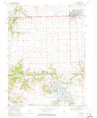
1970 · El Paso
USGS Topo · 1:24,000