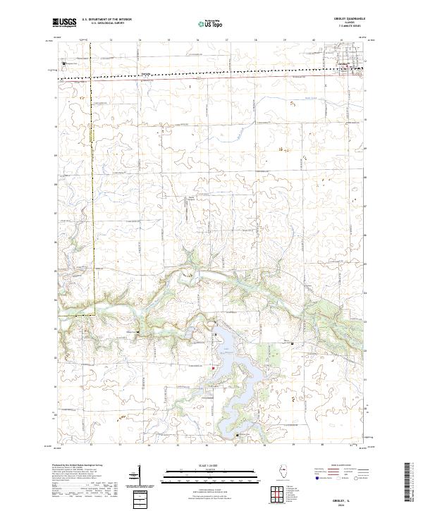
2024 Map of Gridley
USGS Topo · Published 2024About this map
The village of Gridley sits in the northeast corner of this central Illinois landscape, serving as a gateway to the fertile prairie of McLean and Woodford Counties. Just to the west, the settlement of Enright aligns with the rail corridor, while the Mackinaw River carves a winding, forested path through the southern half of the quadrangle. This river valley is significantly shaped by the impoundment of Lake Bloomington, which provides a prominent water feature surrounded by established local landmarks such as the Wilcox - Coon Cem and Hinthorn Cem. The terrain outside the river breaks is defined by a dense grid of rural roads and drainage features like Wolf Creek and Big Slough, illustrating the intensive agricultural development of the region. Local aviation history is represented by Kuntz Airport, situated amongst the expansive fields north of the river.
Find a feature on this map
58 named features on this map. Tap any name to fly to it.
Don’t see what you’re looking for? This feature index may not catch every label — zoom into the map to look around manually.
Map Details
Editions of this 2024 Gridley Map
This is the sole edition of this map. No revisions or reprints were ever made.
Other maps of this area

1926 · Normal
USGS Topo · 1:62,500

1927 · Danvers
USGS Topo · 1:62,500

1930 · Danvers
USGS Topo · 1:62,500

1930 · Normal
USGS Topo · 1:62,500

1955 · Minonk
USGS Topo · 1:62,500

1958 · Flanagan
USGS Topo · 1:62,500

1958 · Peoria
USGS Topo · 1:250,000

1961 · Peoria
USGS Topo · 1:250,000

1963 · Peoria
USGS Topo · 1:250,000
1970 · El Paso
USGS Topo · 1:24,000