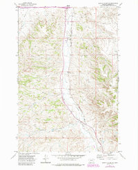
1971 Map of Griffin Coulee NE
USGS Topo · Published 1985About this map
Armells Creek carves a central path through this portion of Rosebud County, Montana, providing a topographical anchor for the surrounding prairie and drainage systems. The landscape is defined by the industrial and transport infrastructure of the early 1970s, featuring a prominent Pipeline and the north-south route of the Burlington Northern railroad. These man-made corridors run parallel to the natural flow of the creek, illustrating how geography dictated the placement of heavy transit and energy networks in this region.
Find a feature on this map
10 named features on this map. Tap any name to fly to it.
Don’t see what you’re looking for? This feature index may not catch every label — zoom into the map to look around manually.
Map Details
Editions of this 1971 Griffin Coulee NE Map
2 editions found
Other maps of this area

1954 · Forsyth
USGS Topo · 1:250,000

1957 · Forsyth
USGS Topo · 1:250,000

1958 · Forsyth
USGS Topo · 1:250,000

1968 · Nichols
USGS Topo · 1:24,000

1968 · Forsyth
USGS Topo · 1:24,000

1968 · Finch
USGS Topo · 1:24,000

1971 · Griffin Coulee SW
USGS Topo · 1:24,000

1971 · Griffin Coulee NE
USGS Topo · 1:24,000
1971 · Smith Creek
USGS Topo · 1:24,000
1971 · Sheep Creek Camp
USGS Topo · 1:24,000