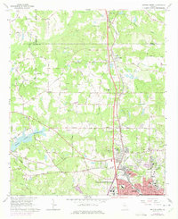
1965 Map of Griffin North
USGS Topo · Published 1975About this map
Griffin anchoring the southern edge of this survey reflects a period of agricultural and industrial transitions in North Central Georgia. The presence of the State Experimental Farms and the community of Experiment highlights the region's commitment to agricultural science, while Highland Mills points toward its manufacturing history. Northward, the land is etched with several named watercourses including Heads Creek and its associated Reservoir, which feed into the rural landscape shaped by long-standing family roads like Halls Road and Manley Road.
Find a feature on this map
54 named features on this map. Tap any name to fly to it.
Don’t see what you’re looking for? This feature index may not catch every label — zoom into the map to look around manually.
Map Details
Editions of this 1965 Griffin North Map
2 editions found
Other maps of this area

1951 · Barnesville
USGS Topo · 1:62,500

1953 · Atlanta
USGS Topo · 1:250,000

1957 · Atlanta
USGS Topo · 1:250,000

1958 · Atlanta
USGS Topo · 1:250,000

1964 · Luella
USGS Topo · 1:24,000
1964 · Mc Donough
USGS Topo · 1:24,000
1965 · Hampton
USGS Topo · 1:24,000

1965 · Fayetteville
USGS Topo · 1:24,000

1965 · Griffin North
USGS Topo · 1:24,000

1965 · Brooks
USGS Topo · 1:24,000